01
Scale
We choose problems whose solutions change the baseline for everyone else. If the work would not matter at planetary scale, we are not the right company for it.
02 / The name
Olympus Mons is the largest volcano on Mars: about 22 km high above the surrounding plains, roughly 600 km across, ringed by cliffs up to 8 km tall.
We took the name because it describes the kind of company we intend to be — something built slowly, at a scale that seems unreasonable until you look at the measurements.
The mountain
Two views of the same volcano. Drag, scroll, or pinch to explore. Every landmark is also described below the map.
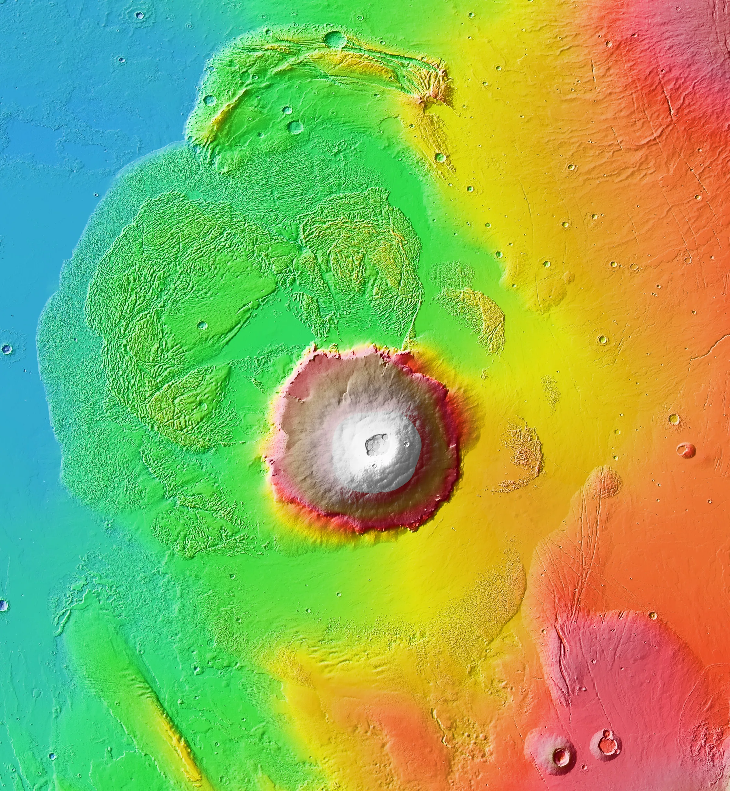
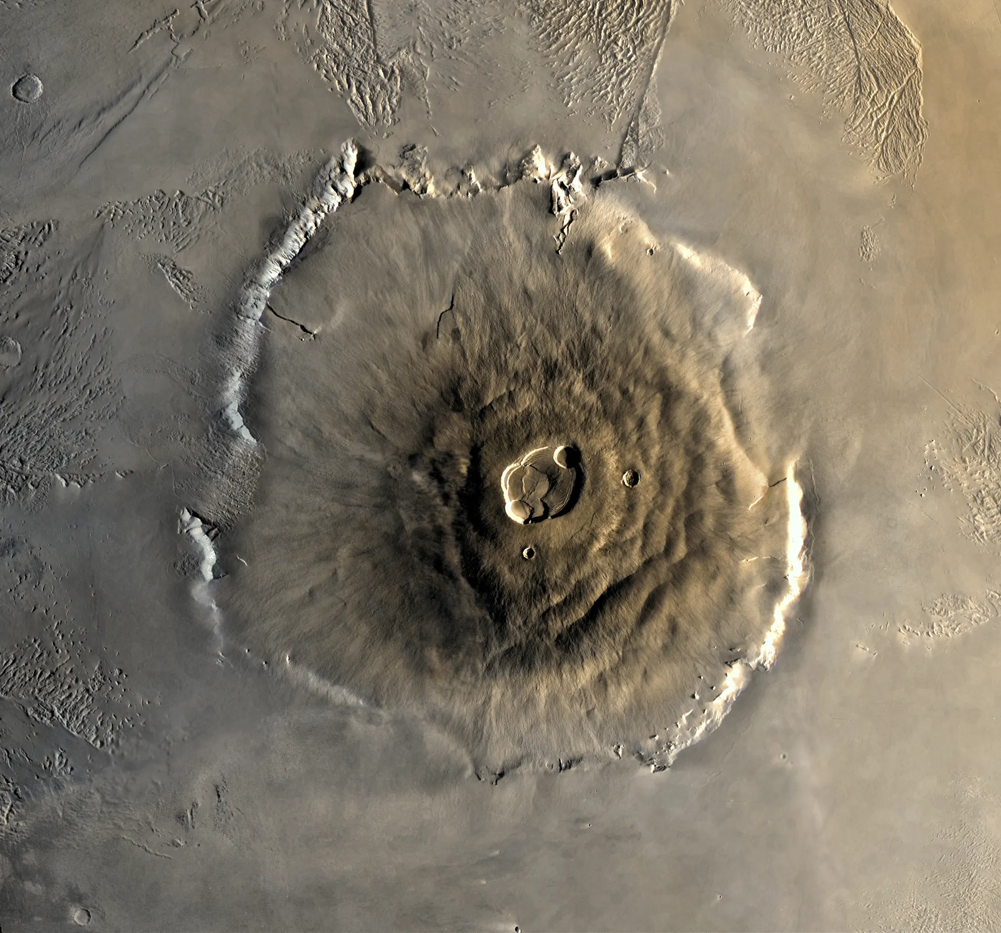
Olympus Mons 18.65°N 226.20°E
Drag to explore · scroll or pinch to zoom · double-click to zoom in
Keyboard: plus and minus zoom, arrow keys pan, 0 resets the view, Escape closes a landmark description.
Landmark
Use the + and − buttons, the scroll wheel, or a pinch gesture to zoom. Drag to pan. Double-click or double-tap to zoom in on a point. With the map focused, use + / − to zoom, the arrow keys to pan, 0 to reset, and Esc to close a landmark card.
Scale is approximate: the full image spans roughly 1,500 km. The three landmarks are also listed in full below the map.
Landmark 01
Six overlapping summit calderas, spanning roughly 65 × 80 km, formed as the magma chamber drained and the surface collapsed. The complex is wide enough to hold a large city.
~65 × 80 km · summit
Landmark 02
The volcano ends in cliffs up to 8 km tall — taller than any cliff on Earth. They mark where the shield's outer edges collapsed under their own weight.
~8 km relief · base
Landmark 03
A halo of landslide deposits and fractured terrain surrounds the base, extending hundreds of kilometers outward — evidence of a mountain slowly spreading under its own mass.
Hundreds of km wide · surrounding plains
The measurements
Height and diameter are approximate and measured from different baselines. Sources: NASA, ESA, USGS.
Where the name comes from
1879 · Giovanni Schiaparelli
Nix Olympica
In 1879, the Italian astronomer Giovanni Schiaparelli published one of the first widely used maps of Mars, naming its features after figures from classical mythology.
One of the brightest patches — a vast bright shield in the western hemisphere — he called Nix Olympica: the snows of Olympus. Olympus was the mountain where the Greeks placed their gods. It was a reasonable guess: something enormous and high and unreachable, somewhere far away.
A century later, orbiters resolved the bright patch into a volcano. It was not a mountain of snow. It was a shield volcano so large that its summit sits above most of the Martian atmosphere, its base is ringed by cliffs taller than any on Earth, and its calderas could swallow a city.
Olympus Mons — Mount Olympus — turned out to be the wrong name for the right reason. It was, in fact, the home of the gods.
We borrowed it because it is the best available shorthand for a specific kind of ambition: not to be the biggest, but to be built at a scale where “biggest” stops being the interesting question.
What the name commits us to
The name is not a decoration. It sets the standard we are held to.
01
We choose problems whose solutions change the baseline for everyone else. If the work would not matter at planetary scale, we are not the right company for it.
02
Olympus Mons grew over billions of years, one flow at a time. Revolutionary technology is the same: unglamorous iteration, compounded. We plan in decades and report in weeks.
03
A mountain is measurable. So is our work. We publish what we built, what failed, and what we still do not know.
For scale
Heights are only comparable when the baseline is the same. These bars use each feature's own accepted reference surface, and say so.
Not a like-for-like elevation comparison. Olympus Mons is about 2.5× Everest's height above sea level, which is a different measurement from Everest's base-to-peak relief.